A Bengal atlas : containing maps of the theatre of war...


 Maps, plans and nautical charts
A Bengal atlas : containing maps of the theatre of war and commerce on that side of Hindoostan (1780)
- Rennell, James, 1742-1830
Maps, plans and nautical charts
A Bengal atlas : containing maps of the theatre of war and commerce on that side of Hindoostan (1780)
- Rennell, James, 1742-1830
 Disponible Holdings
 Section: Maps, plans and nautical charts
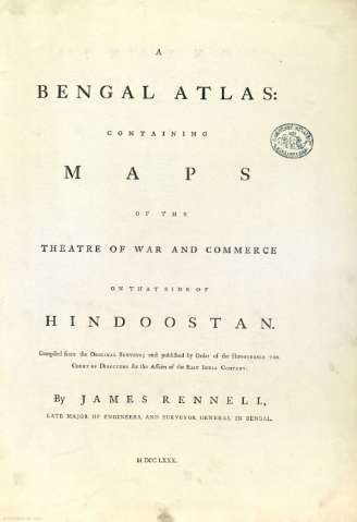
Title: A Bengal atlas : containing maps of the theatre of war and commerce on that side of Hindoostan / by James Rennel, late Major of Engineers, and Surveyor General in Bengai
Author: Rennell, James, 1742-1830
Material or type of resouce Area: Varias escalas
Publication: Inglaterra : [Editor no identificado], 1780
Physical description: 1 atlas : 13 lám. ; 49 x 35 cm
Content type: Imagen cartográfica
Media type: computadora
Carrier type: recurso en línea
Notes: Escalas expresadas "In Square British Miles"
Orientado con lis
Márgenes graduados
Red hidrográfica y de caminos
Relieve representado por símbolos
Señala vegetación
Divisiones administrativas diferenciadas por color
Ciudades representadas según su importancia
Contiene: lám. 1. The Delta of the Ganges -- Lám. 2. The Jungleterry District, Birboom, Rajemal, Boglipour. -- Lám. 3. A Map of South Bahar. -- Lám. 4. A Map of North Bahar. -- Lám. 5. The Northern Provinces of Bengal; with the Bootan, Morung & Assam Frontiers. -- Lám. 6. The Low Countries Beyond the Ganges. -- Lám. 7. The Provinces of Bengal Situated on the weft of the Hoogly River. -- Lám. 8. The Conquered Provinces on the fouth of Bahar. -- Lám. 9. Map of Bengal & Bahar. -- Lám. 10. Map of Oude & Allahabad; with part of Agra & Delhi. -- Lám. 11. Map of the Cossimbuzar Island. -- Lám. 12. Plan of the Environs of the city of Dacca. -- Lám. 13. The Doo = Ab, from Allahabad to Kalpy
Copia digital. Madrid : Ministerio de Cultura, 2010
Included records: The conquered provinces on the south of Bahar : containing Ramgur, Palamow & Chuta-Nagpour
The Delta of the Ganges with the adjacent countries on the East : comprending the southern inland navigation
[...] Ver todos los registros incluidos (13)
Materia / lugar / evento: Mapas generales
Divisiones administrativas
Ríos
Colonias
Atlas
Bengala
Ganges (Río)
Indias Orientales
Related titles: India. Mapas generales. 1780
UDC: (540.33)"1780"
Type of publication:
Maps
Rights:
Préstamo:
 Disponible sólo para consulta en sala
