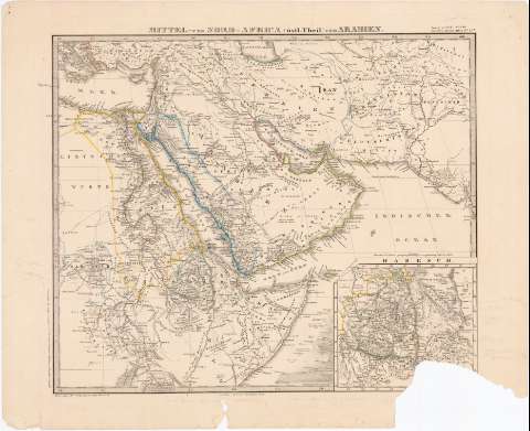
Mittel und Nord - Africa (Ostl. Theil) und Arabien
Section: Maps, plans and nautical charts
Uniform title: MAR ROJO. Mapas generales. 1:8500000 (1867)
Title: Mittel und Nord - Africa (Ostl. Theil) und Arabien
Material or type of resouce Area: Escala [ca. 1:8500000], 100 Deutsche Meilen [= 6 cm] ; proyec. Meridiana
Publication: Gotha : Justus Perthes, 1868
Physical description: 1 mapa : col. ; 32x38 cm en h. de 38,5x47 cm
Content type: Imagen cartográfica
Media type: computadora
Carrier type: recurso en línea
Notes: Presenta además un mapa de 'Habesch'
Coordenadas referidas al parecer al meridiano de Hierro (E40°0'-E85°0'/N35°20'-N0°0') Red geografica de 5° en 5°
Relieve representado por normales
En el margen superior derecho 'Aug in 63 Bl. N LIII Stieler's Hand - Atlas (N 45 b)
Other authors: Perthes, Justus, 1749-1816
UDC: 912:(267.33)'1867'
(532)
(620)
(624)
(63)
(6 77)
Type of publication:
![]() Maps
Maps
Préstamo:
![]() Disponible
Disponible


