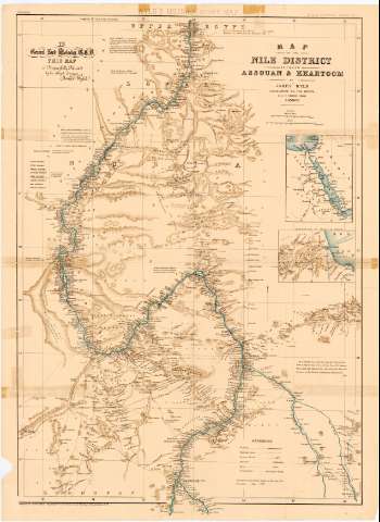
Map of the Nile District between Assovan & Khartoom
Section: Maps, plans and nautical charts
Uniform title: AFRICA. NE. Mapas generales. 1:2000000 (183)
Title: Map of the Nile District between Assovan & Khartoom / by James Wyld Geographer to the Queen 11 & 12 Charing Cross
Material or type of resouce Area: [Ca. 1:2000000], 50 British Miles [= 6,5 cm]
Publication: London : Published by James Wyld Geographer to the Queen 11, 12 Charing Cross, [183-?]
Physical description: 1 mapa : col. ; 88 x 59 cm en h. de 87 x 64 cm, pleg. en 43, 5 x 64 cm
Content type: Imagen cartográfica
Media type: computadora
Carrier type: recurso en línea
Notes: Dedicatoria: "To General Lord Molseleg this map in Respect Jully Dedicated by his obliged servant James Ssyld"
Presenta además un mapa de detalle de la ruta de Suakim
Escala gráfica de 100 km [= 8 cm]. Red geográfica de 1° en 1°. Orientado con flecha
Relieve representado por normales
Tabla de signos convencionales para indicar las vías de comunicación, telégrafos
Other authors: Wyld, James, 1812-1887
UDC: 912:282.2(6-18)'1830/1839'
6-18
Type of publication:
![]() Maps
Maps
Préstamo:
![]() Disponible
Disponible


