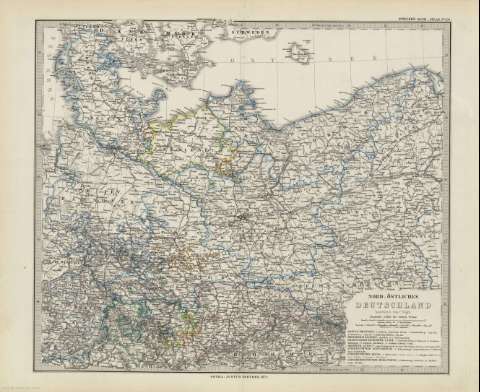
Nord-Östliches Deutschland : [generalkarte]


 Disponible Holdings
 Section: Maps, plans and nautical charts
Material or type of resouce Area: 1:1.850.000
Publication: Gotha [Alemania] : Justus Perthes, 1879
Physical description: 1 mapa : col. ; 34 x 39 cm en h. de 39 x 48 cm, pleg. en 39 x 24 cm
Content type: Imagen cartográfica
Media type: computadora
Carrier type: recurso en línea
Notes: Coordenadas referidas al meridiano de Hierro (E 6 -E 17 /N 56 -N 50)
Relieve representado por normales
Leyenda de signos utilizados
En el margen superior derecho : "Stieler's Hand-Atlas Nº 20"
Copia digital . España : Ministerio de Cultura y Deporte. Subdirección General de Coordinación Bibliotecaria, 2010
Other titles: En: Hand atlas : über alle Theile der Erde und über das Weltgebäude. - Gotha [Alemania R.D.] : Justus Perthes, [1879]. - N. 20
Materia / lugar / evento: Mapas generales
Alemania
Other authors: Stieler, Adolf, 1775-1836
Justus Perthes (Firma)
Related titles: Alemania. Mapas generales. 1:1850000 (1879)
UDC: 912:341.222(430.1-2/-5)'1879'
430.1
Type of publication:
 Maps
Maps
Rights:
