Hand atlas : über alle Theile der Erde und über das...


 Maps, plans and nautical charts
Hand atlas : über alle Theile der Erde und über das Weltgebäude (1879)
- Stieler, Adolf, 1775-1836
Maps, plans and nautical charts
Hand atlas : über alle Theile der Erde und über das Weltgebäude (1879)
- Stieler, Adolf, 1775-1836
 Disponible Holdings
 Section: Maps, plans and nautical charts
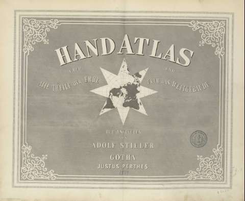
Title: Hand atlas : über alle Theile der Erde und über das Weltgebäude / herausgegeben von Adolf Stieler
Author: Stieler, Adolf, 1775-1836
Material or type of resouce Area: Varias escalas
Publication: Gotha [Alemania R.D.] : Justus Perthes, [1879]
Physical description: 1 atlas (99 hoja, 11 páginas) : 68 mapas col. ; 40 cm
Content type: Imagen cartográfica
Media type: computadora
Carrier type: recurso en línea
Notes: Atlas conocido comunmente por 'Stieler's Hand Atlas', editado por primera vez en 1816 y reeditado con correcciones en años sucesivos
Meridiano de Greenwich principalmente, ademas Tenerife, Ferro, Paris, Washington
Indice de mapas contenidos
Incluye 11 p. de texto intituladas 'Vorbericht zu Stieler's Hand - Atlas'
Encuadernado en tela verde con lomo y cantoneras en piel
Copia digital. Madrid : Ministerio de Cultura. Dirección General del Libro, Archivos y Bibliotecas, 2010
Copia digital . España : Ministerio de Cultura y Deporte. Subdirección General de Coordinación Bibliotecaria, 2010
Included records: Afrika . - Gotha [Alemania] : Justus Perthes, 1879
Palästina im maassstabe von 1:1.200.000 : [generalkarte]. - Gotha [Alemania] : Justus Perthes, 1879
[...] Ver todos los registros incluidos (67)
UDC: 912:341.22(100)'1879'
100
Type of publication:
Maps
Rights:
