Storm and rain chart of the North Atlantic : Series E.


 Maps, plans and nautical charts
Storm and rain chart of the North Atlantic : Series E. (1853)
- Maury, Matthew Fontaine, 1806-1873
Maps, plans and nautical charts
Storm and rain chart of the North Atlantic : Series E. (1853)
- Maury, Matthew Fontaine, 1806-1873
 Disponible Holdings
 Section: Maps, plans and nautical charts
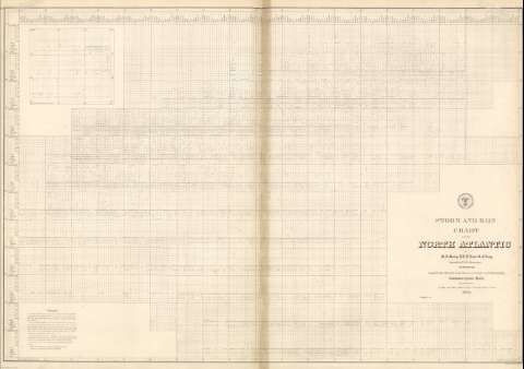
Title: Storm and rain chart of the North Atlantic : Series E. / by M.F. Maury, L.L.D. Lieut. U.S. Navy Superind't of U.S.N. Observatory. Washington ; Compiled from materials in the Bureau of Ordnance and Hydrography ; Commodore Charles Morris, chief of Bureau ; by Lieuts. George Minor, William H. Ball, and W. Rodgers Taylor, U.S. Navy 1853
Author: Maury, Matthew Fontaine, 1806-1873
Material or type of resouce Area: [Ca. 1:12919896] (O 85°00'-E 10°00'/N 60°00'-N 0°00')
Publication: Washington : United States Hydrographical Office, 1853
Physical description: 1 mapa ; 61 x 89 cm
Content type: Imagen cartográfica
Media type: computadora
Carrier type: recurso en línea
Notes: Océano Atlántico, Series E, N.º 20
Presenta la previsión atmosférica en el Atlántico N. con tablas que muestran la posibilidad de temporal, lluvia, tormentas o nieblas que existe en cada punto, cada día del año
Escala hallada según grado de meridiano [= 0,86 cm]
Other titles: En: Wind and current chart. - Washington : United States Hydrographical Office, 1849-1856. - 20
Other authors: Ball, William H
Morris, Charles, 1784-1856
Minor, George
Taylor, W. Rodgers
Estados Unidos. Bureau of Ordnance and Hydrography
Estados Unidos. Hydrographic Office
Related titles: Atlántico (Océano). Mapas climáticos. 1853. 1:12919896
UDC: 912:551.5]:551.509(261)"1852"
261
Type of publication:
Maps
Préstamo:
 Disponible sólo para consulta en sala
