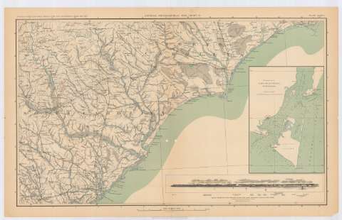
General topographical map. Sheet IV : [U.S.A., South and...
Section: Maps, plans and nautical charts
Title: General topographical map. Sheet IV : [U.S.A., South and North Carolina]
Material or type of resouce Area: Escala [ca. 1:633594], 10 miles to 1 inch (O81 10'-O76 30'/N34 55'-N32 35')
Publication: Washington : Government Printing Office, [189-?] (N.Y. [Nueva York] : Julius Bien & co.)
Physical description: 1 mapa : col. ; 42x70 cm, en h. de 47x75 cm
Content type: Imagen cartográfica
Media type: computadora
Carrier type: recurso en línea
Notes: En : Atlas to accompany the Official Records of the Union and Confederate Armies 1861 - 1865. - Plate CXXXIX
Relieve : lineas perpendiculares normales
Inserta 1 vista : 'Rebel works for the defense of the new inlet entrance to cape Fear liver'
En : Atlas to accompany the Official Records of the Union and Confederate Armies 1861 - 1865
Entrances to Cape Fear River, North Carolina
Materia / lugar / evento: Guerra civil
Mapas topográficos
Divisiones administrativas
Redes de transporte
Fortificaciones
Perspectivas de costas
S.XIX
Carolina del Norte
Carolina del Sur
Estados Unidos
UDC: 912:355.4]:[551.468+623.2](756+757)'1861/1865'
912:528.473-2/-5) '1861/1865'
756
757
Type of publication:
![]() Maps
Maps
Préstamo:
![]() Disponible
Disponible


