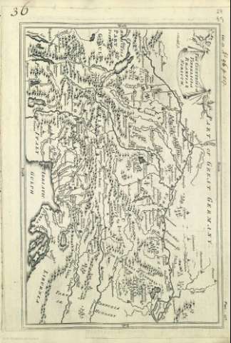
The Countries of Vindelicia, Rhaetia & Noricum


Section: Maps, plans and nautical charts
Uniform title: Europa central. Mapas generales. 1700-1812
Title: The Countries of Vindelicia, Rhaetia & Noricum / J. Blundell Sc.
Other titles: The Countries of Vindelicia, Rhaetia and Noricum
Material or type of resouce Area: Escala indeterminada
Physical description: 1 mapa
Content type: Imagen cartográfica
Media type: computadora
Carrier type: recurso en línea
Notes: Orientado
Ciudades representadas por pequeñas edificaciones
Relieve por montes de perfil y sombreado
Costas sombreadas con un fino rayado
Arbolado
Red hidrográfica
Toponimia de las regiones, algunos nombres de ciudades, montañas, lagos y ríos
Título en servilleta sostenida por dos angelotes
Copia digital . Madrid : Ministerio de Cultura, 2010
Ámbito geográfico: El mapa abarca parte de las actuales Italia, Alemania, Austria, Suiza, Eslovenia
Other titles: En: [The maps and plans of the Universal History]. - [Lugar de publicación no identificado] : [Editor no identificado], [1700-1812?]. - [Mapa 29]
Materia / lugar / evento: Mapas históricos
Geografía histórica
Mapas generales
Accidentes geográficos
Historia
Edad media
Europa Central
UDC: (398)
(4-191.2)
Type of publication:
 Maps
Maps
