[The maps and plans of the Universal History]


 Disponible Holdings
 Section: Maps, plans and nautical charts
Uniform title: Mundo. Mapas generales (ca. 1700-1812)
Title: [The maps and plans of the Universal History]
Material or type of resouce Area: Varias escalas
Publication: [Lugar de publicación no identificado] : [Editor no identificado], [1700-1812?]
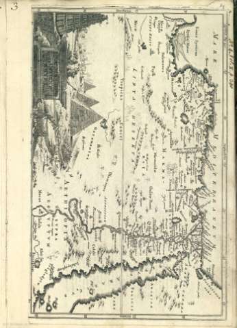
Physical description: 1 atlas [8] h., 39 mapas : principalmente il. ; 35 x 26 cm
Content type: Imagen cartográfica
Media type: computadora
Carrier type: recurso en línea
Notes: En la contracubierta: "Recopilación de diferentes mapas y láminas hecha por el oficial inglés James Angier, ayudante de campo del general Wellington a la dueña de la casa Granga Baïte de San Juan de Luz donde se hospedaron durante la última campaña contra el general Soult en 1812. La descendiente de la referida señora Leonie Leremboure lo regaló a Santiago Jimenez en 1942; su hijo Santiago en 1942; su hijo Santiago Jiménez Lambille lo donó al Museo Naval, el 3 de septiembre de 1992"
En algunas láminas aparece el nombre del autor
Relieve por montes de perfil y sombreado
Toponimia de las regiones, algunos nombres de ciudades, montañas, lagos y ríos
Red hidrográfica
Algunas láminas con elementos decorativos
Índice
Algunas láminas con elementos decorativos
Título propio tomado del índice de las láms
Título tomado del índice de las láminas
Copia digital. Madrid : Ministerio de Cultura, 2010
Included records: A general map of the Roman Empire : thenving the situation of all its Provinces & the seats of the Barbarous Nation on their frontiers
A map of the extent of Alexanders conquests According to Mr Delifle Geographer to Lewis 14. Compared with tose of other Moder Geographer An: 1731
[...] Ver todos los registros incluidos (38)
Materia / lugar / evento: Mapas generales
Núcleos de población
Accidentes geográficos
Planos de población
Perspectivas
Elementos arquitectónicos
Atlas
Siglo XVIII
Mundo
UDC: (100)
Type of publication:
 Maps
Maps
Rights:
Préstamo:
 Disponible sólo para consulta en sala
