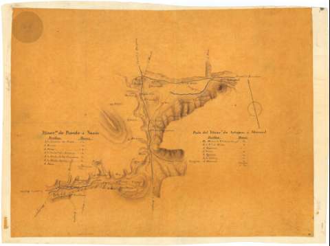
Ytiner°. de Puente La Reina á Noain [y] Parte del Ytiner°...
Section: Maps, plans and nautical charts
Uniform title: AOIZ (Navarra). Itinerarios. Escala indeterminada (18--)
Title: Ytiner°. de Puente La Reina á Noain [y] Parte del Ytiner°. de Artajona á Monreal
Material or type of resouce Area: Escala indeterminada
Physical description: 1 mapa : ms., col. ; 36,4 x 48,7 cm
Notes: El itinerario de Artajona a Monreal queda interrumpido a la altura del puerto del Carrascal. Entre los dos itinerarios comprenden parte de los partidos judiciales de Pamplona y Aoiz, pasando, entre otras, por las poblaciones de Obanos, Murvarte de Reta, Olcoz
Orientado al norte geográfico
Relieve representado por sombreado
Figuran dos tablas itinerarias que permiten conocer la distancia en horas de camino existentre entre algunos de los puntos de tránsito del recorrido
Materia / lugar / evento: Itinerarios
S.XIX
Pamplona
Navarra (Comunidad Autónoma)
UDC: (460.16 Aoiz)
Type of publication:
![]() Maps
Maps
Préstamo:
![]() Disponible
Disponible


