Corso del Tagliamento]


-
Section: Maps, plans and nautical charts
Uniform title: TAGLIAMENTO (Italia) (Río). Cuencas fluviales. 1:150000 (17)
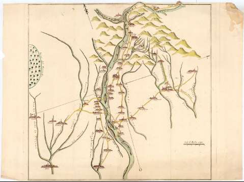
Title: Corso del Tagliamento]
Material or type of resouce Area: Escala [ca. 1:150000], 5 Miglia [= 6,1 cm]
Publication: [Italia ? : [Editor no identificado], 17-- ?]
Physical description: 1 mapa : col. ; 53,4x54,5 cm en h. de 53,4x71,5 cm
Content type: Imagen cartográfica
Media type: computadora
Carrier type: recurso en línea
Notes: Título propio redactado a partir del contenido del documento
Orientado con flecha en cuadrante
Relieve de perfil
Indica la red de caminos de esta zona, los edificios de las distintas ciudades en alzado y el curso del río Tagliamento con flecha.Materia / lugar / evento: Cuencas hidrográficas
Siglo XVIII UDC: 912:551.468(282.24 Tagliamento)'17'
282.24 TagliamentoType of publication:
 Maps
Maps
Rights:
Archivo Cartográfico de Estudios Geográficos del Centro Geográfico del EjércitoLocation: AR — Call number: Ar.L-T.9-C.5-158 — Código de barras: 2214093Préstamo:
 Disponible