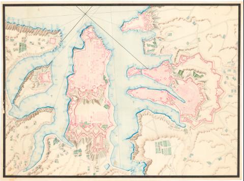
Plano de la Valletta]


-
Section: Maps, plans and nautical charts
Title: Plano de la Valletta]
Material or type of resouce Area: Escala indeterminada
Publication: [183- ?]
Physical description: 1 plano : ms., col. ; 45x61,6 cm en h. de 47,3x64 cm
Notes: Título propio tomado del Catálogo del SG : 'Mapas de Italia, 2_a Parte Siglos XVII al XIX'. 1976, p. 219
Manuscrito a plumilla en tinta negra y roja e iluminado a la acuarela en azul, gris, verde, carmín y ocre
Relieve representado por sombreado
Indica fondeaderos y nudo de rumbos
Presenta fortificaciones
ITLMateria / lugar / evento: Planos de población
Fortificaciones
Siglo XIX UDC: 912:623.2(458.2 Valletta)'1830/1839'
912:314(458.2 Valletta) '1830/1839'(084.3)Type of publication:
 Maps
Maps
Rights:
Archivo Cartográfico de Estudios Geográficos del Centro Geográfico del EjércitoCollection: PCGE — Location: AR — Call number: Ar.H-T.7-C.7-219 — Código de barras: 2212644Préstamo:
 Disponible