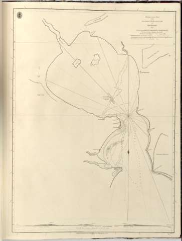
Bembatooka Bay on The Island of Madagascar


 Disponible Holdings
 Section: Maps, plans and nautical charts
Uniform title: BOMBETOKA (Madascar) (Bahia). Cartas náuticas. 1:92590 (1802)
Title: Bembatooka Bay on The Island of Madagascar / by David Inverarity ; T. Harmar Scr. T. Harmar
Material or type of resouce Area: Escala [Ca. 1:92.590]
Publication: [London ?] : Published by A. Dalrymple, 1806
Physical description: 1 carta nautica ; 61x46 cm en h. de 65x50 cm
Content type: Imagen cartográfica
Media type: computadora
Carrier type: recurso en línea
Notes: Presenta además 1 perfil
En : Charts Red Sea
Escala grafica hallada a partir de un grado de latitud [= 50 cm]. Coordenadas de la Bahia de Bembatooka referidas al meridiano de Greenwich (Latitud 15°50'-Longitud 46°33'). Orientado con lis en nudo de rumbos
Relieve representado en sondas batimetricas
Indica veriles, bajos y fondeaderos
Nota sobre la profundidad del agua en la Bahia en las diferentes estaciones
Sello 'Hydrographical Office'
En : Charts Red Sea
Other authors: Inverarity, David
Dalrymple, Alexander
Harmer, Thomas
UDC: 912:[551.46:528.9](691)'1802'
691
Type of publication:
 Maps
Maps
Rights:
Préstamo:
Disponible
