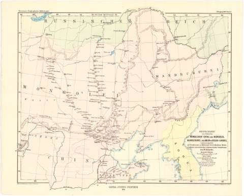
Originalkarte lines theiles des Nordlichen China, der...
Section: Maps, plans and nautical charts
Uniform title: Asia. Mapas generales. 1:8000000 (1869-1872)
Title: Originalkarte lines theiles des Nordlichen China, der Mongolei, Mandschurei, des Amur-& Ussuri-Landes : Zusammengestellt auf Grund never in 1869/72 auf 13 verschiedenen Reisen erhaltener astronomischen u nypsometrischer Beobachtungen / von Dr. Fritsche ; Red. von A. Petermann ; autogr. von B. Domann ; Druck. von C. Hell
Material or type of resouce Area: 1:8000000 ; [proyec. estereográfica] (E 102°-E 136°30'/N 50°47'-N 34°28')
Publication: Gotha : Justhus Perthes, 1874
Physical description: 1 mapa : col. ; 28 x 34,8 cm
Content type: Imagen cartográfica
Media type: computadora
Carrier type: recurso en línea
Notes: Comprende la Republica Democrática Popular de Corea, parte de Rusia, de Mongolia y de China
En: Petermann's Geographische Mittheilungen. Jahrgang 1874. N. 12
Red geográfica de 2° en 2°
Relieve representado por normales y puntos acotados
Procede de la "Colección Coello"
UDC: 912(5-11)'1869/1872'
(519.3)
(47+57-13)
(517-11)
(510-18)
Type of publication:
![]() Maps
Maps
Préstamo:
![]() Disponible
Disponible


