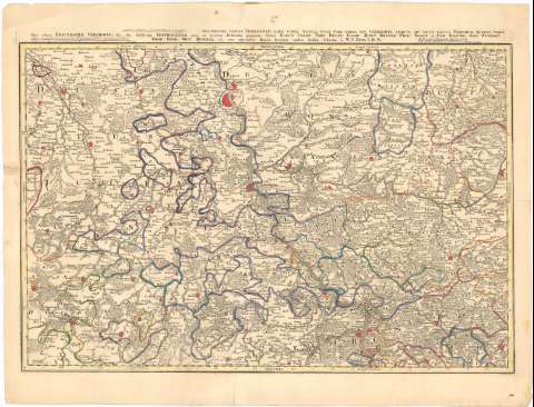
Exactissima totius vederoviae laté suntae tabula, cuius...
Section: Maps, plans and nautical charts
Uniform title: RHIN SEPTENTRIONAL-WESTFALIA (Alemania). 1:150000 (1762)
Title: Exactissima totius vederoviae laté suntae tabula, cuius Para prima est vederovia stricte sis dicta versus meridiem ... / W.C. Buna V.D.M. ; A. Reinhardt fc
Material or type of resouce Area: Escala [ca. 1:150000]. Hore quorundam Locarum, quorum IV efficiunt 3 milliaria Germanica five 6 Horas [= 15 cm]
Publication: [Frankfurt ? : Broenner, 1762 ?]
Physical description: 1 mapa : col. ; 61x81 cm
Content type: Imagen cartográfica
Media type: computadora
Carrier type: recurso en línea
Notes: Escala gráfica de 111 'Horae itinens Vestrovaldae' [= 7,2 cm] Coordenadas referidas al parecer al meridiano de hierro (E25°30'-E27°35'/N51°25'-N50°30')
Relieve de perfil
En el margen superior : '1a.'
Indica núcleos de población mediante edificios de perfil y masas forestales
Sello en seco del Depósito de la Guerra
Materia / lugar / evento: Mapas generales
1762
Other authors: Buna, Wilhelm C
Broenner, Heinrich Ludwig
Reinhardt, Andreas
UDC: 912(430-328 Rhin Septentrional-Westfalia)'1762'
430-328 Rhin Septentrional-Westfalia
Type of publication:
![]() Maps
Maps
Préstamo:
![]() Disponible
Disponible


