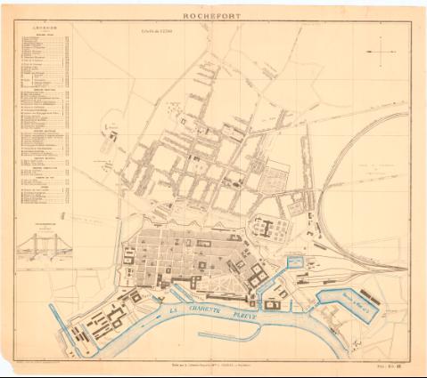
Rochefort
Section: Maps, plans and nautical charts
Uniform title: ROCHEFORT (Francia). Planos de población. 1:7500 (189)
Title: Rochefort / Alb. Gaudon Graveur
Material or type of resouce Area: Escala 1:7500
Publication: Rochefort : Edité par la Librairie Papeterie Mele. C. Gazeau, [189- ?] (Blois : Typ. & Lith. C. Migault & Cie., [189- ?])
Physical description: 1 plano : col. ; 49,6x56,7 cm
Notes: Orientado con flecha en cuadrante
Relación de los principales edificios civiles, religiosos y militares referidos a la cuadrícula del plano
Indica la dirección del río con flecha
FRN
Materia / lugar / evento: Planos de población
Siglo XIX
Other authors: Gaudon
Librairie Papeterie C. Gazeau (Rochefort)
Typographie & Lithographie C. Migault et Compagnie (Blois)
UDC: 912:314(44-Rochefort)'189-'(084.3)
44-Rochefort
Type of publication:
![]() Maps
Maps
Préstamo:
![]() Disponible
Disponible


