Bacon's bird's eye view of South Africa : with inset...


 Maps, plans and nautical charts
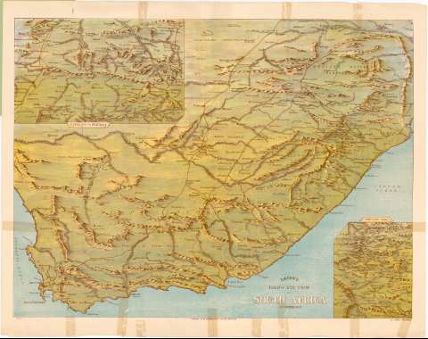
Bacon's bird's eye view of South Africa : with inset wiews of Natal and Mafeking District (1900)
Maps, plans and nautical charts
Bacon's bird's eye view of South Africa : with inset wiews of Natal and Mafeking District (1900)
 Disponible Holdings
 Section: Maps, plans and nautical charts
Uniform title: SUDAFRICA. Mapas generales. 1:700000 (1900)
Title: Bacon's bird's eye view of South Africa : with inset wiews of Natal and Mafeking District
Material or type of resouce Area: Escala [ca. 1:700000]
Publication: London : G.W. Bacon & Co., Ltd., 127 Strand, 1900
Physical description: 1 mapa : col. ; 68x86 cm, pleg. en 68x44 cm
Content type: Imagen cartográfica
Media type: computadora
Carrier type: recurso en línea
Notes: Presenta además un mapa de mafeking a Pretoria y otro del norte de Natal
Pertenece al 'Bacon's War - Maps'
Relieve de perfil
Acompañado de un cuadernillo (7 p.) 'the South African Crisis'
Materia / lugar / evento: Mapas generales
1900
Lesotho
Swazilandia
Other authors: G.W. Bacon & Co. (Londres)
UDC: 912(680)'1900'
(686)
(683)
Type of publication:
Maps
Rights:
Préstamo:
Disponible
