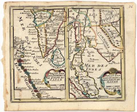
Presqu isle del Indedela le Golfe de Gange


 Disponible Holdings
 Section: Maps, plans and nautical charts
Uniform title: Tailandia (Golfo). Mapas generales. 1:18000000 (166)
Title: Presqu isle del Indedela le Golfe de Gange
Material or type of resouce Area: Escala [ca. 1:18000000], 60 lienes d'une heure de chemin [= 1,9 cm]
Publication: [Bruxelles : J.P. Harrewys, 166- ?]
Physical description: 1 mapa : col. ; 15,3x18 cm
Content type: Imagen cartográfica
Media type: computadora
Carrier type: recurso en línea
Notes: Coordenadas referidas, al parecer, al meridiano de Paris (E134°00'-E147°00'/N22°00'-N0°00')
Relieve de perfil
En el margen superior izquierdo, '36'
Presqu' isle del'Indedeca le Golfe du Gauge
Materia / lugar / evento: Mapas generales
Divisiones administrativas
Islas
S.XVII
Camboya
Thailandia
Malasia
Other authors: Harrewys, J. P
UDC: 912:551.42(26.04 Tailandia)'1660/1669'
(596)
(593)
(595)
Type of publication:
 Maps
Maps
Rights:
Préstamo:
Disponible
