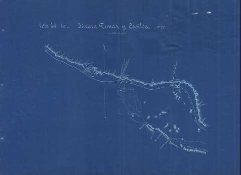
Costa del Sur, Jucaro, Tunas, y Casilda


 Disponible Holdings
 Section: Maps, plans and nautical charts
Title: Costa del Sur, Jucaro, Tunas, y Casilda
Material or type of resouce Area: Escala indeterminada
Publication: 1889?]
Physical description: 1 carta náutica ; 44 x 60 cm
Content type: Imagen cartográfica
Media type: computadora
Carrier type: recurso en línea
Notes: Comprende el sur de la costa de la provincia de Sancti Spíritus, entre la ciudad de Júcaro y Casilda
Orientado con media flecha
Relieve por sombreado
Indica sondas batimétricas, veriles, bajos, fondeaderos, así como las líneas de derrota que sigue el litoral costero
Es una fotocopia en ferroprusiato
Inserta: [Planos de población de Júcaro, Tunas de Zaza y Casilda. Escala indeterminada
Pertenece a: "Memorias de la comisión de estudios y defensa de costas de la Isla de Cuba. Croquis 1889", correpondiéndose con la "(No. 29)"
Materia / lugar / evento: Mapas generales
Cartas náuticas
Batimetría
Planos de población
Ciego de Ávila
Júcaro
Las Tunas (Provincia)
Tunas de Zaza
Casilda
UDC: (729.14)
Type of publication:
 Maps
Maps
Rights:
Préstamo:
Disponible
