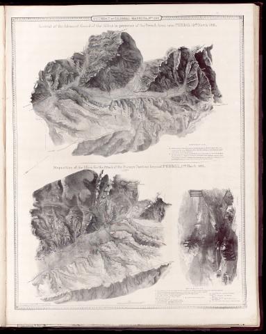
Arrival of the Advanced Guard of the Allies in presence...
Section: Maps, plans and nautical charts
Uniform title: POMBAL (Portugal). Operaciones militares. 1840. Escala [ca. 1:50 000]. 2 Miles [= 6,40 cm] (1811)
Title: Arrival of the Advanced Guard of the Allies in presence of the French Army near Pombal : 10th. March 1811 [Material cartográfico] / surveyed and drawn by the Major Pierrepoint ; finished by Major T.L. Mitchell ; on zinc by Erxleben
Material or type of resouce Area: Escala [ca. 1:50 000]. 2 Miles [= 6,40 cm]
Physical description: 1 mapa ; 84 x 64 cm
Notes: Relieve representado por normales
Vegetación representada en algunas zonas
Leyenda explicativa con el desarrollo de la contienda indicado por clave alfabética
Mapa n. 1 de un total de 10, impresos en conjuntos de 2, que pertenece a la "Retreat of Marshal Massena" de 1811
Disposition of the allies for the attack of the enemy's position beyond Pombal
Materia / lugar / evento: Operaciones militares
Guerras de independencia
1811
Pombal
Portugal
Gran Bretaña
Other authors: Wyld, James, 1812-1887
Pierrepoint
Mitchell, Thomas Livingston Sir, 1792-1855
Erxleben
UDC: 469
Type of publication:
![]() Articles and chapters
Articles and chapters


