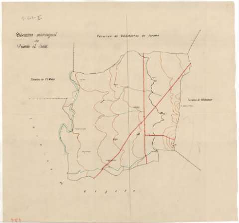
Término municipal de Fuente el Saz


Section: Maps, plans and nautical charts
Uniform title: Fuente el Saz de Jarama (Madrid) (Término municipal). Mapas topográficos. 194-. 1:25.000
Title: Término municipal de Fuente el Saz / Instituto Geográfico y Catastral
Material or type of resouce Area: Escala [1:25000]
Publication: [194-]
Physical description: 1 map. : ms., col., papel cebolla ; 46 x 49 cm
Content type: Imagen cartográfica
Media type: computadora
Carrier type: recurso en línea
Notes: Manuscrito en varias tintas
Relieve representado por curvas de nivel
Materia / lugar / evento: Madrid (Comunidad Autónoma) - Mapas
Fuente el Saz de Jarama - Mapas
Genre / form: Mapas topográficos
Other authors: Instituto Geográfico y Catastral (España)
UDC: 912.43(460.27)"19"
460.27Fuente el Saz
Type of publication:
 Maps
Maps
Rights:
Préstamo:
 Disponible
