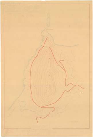
[Punta Cires]
Section: Maps, plans and nautical charts
Title: [Punta Cires] / Servicio Geográfico, Sección Topográfica de Ceuta, El comandante de E.M. Inspector Jefe Luis Aparicio
Author: España. Servicio Geográfico del Ejército. 1:5.000
[Punta Cires] All editions
Characteristics of the edition: 1941. Español
Material or type of resouce Area: Escala 1:5.000
Publication: [1941]
Physical description: 1 plano : copia en ozalid ; 55 x 36 cm
Content type: Imagen cartográfica
Media type: computadora
Carrier type: recurso en línea
Notes: Relieve rpresentado por curvas de nivel con una equidistancia de 5 m
Indica la ubicación de Punta Cires y sus vías de acceso
Subrayado con posterioridad accesos e hidrográfia y destacada la línea costera
Materia / lugar / evento: Accidentes geográficos
1941
Tánger (Provincia)
Marruecos (Protectorado Español)
Genre / form: Mapas topográficos
Other authors: Aparicio Miranda, Luis, 1899-1996
UDC: (64 Tánger, provincia)
(64 Punta Cires)
Type of publication:
![]() Maps
Maps
Préstamo:
![]() Disponible
Disponible


