Philip's Mercantile Marine Atlas


 Maps, plans and nautical charts
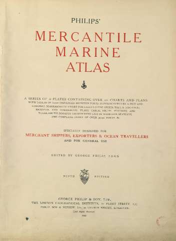
Philip's Mercantile Marine Atlas (1922)
- Philip, George, 1870-1937
Maps, plans and nautical charts
Philip's Mercantile Marine Atlas (1922)
- Philip, George, 1870-1937
 Disponible Holdings
 Section: Maps, plans and nautical charts
Title: Philip's Mercantile Marine Atlas
Author: Philip, George, 1870-1937
Edición: Ninth edition
Material or type of resouce Area: Varias escalas
Publication: [London] : Edited by George Philip [et al.], 1922
Physical description: 1 atlas ([78]h.) : 33 map., 1 lám., col. ; 53 cm
Content type: Imagen cartográfica
Media type: computadora
Carrier type: recurso en línea
Notes: Atlas compuesto de treinta y tres mapas de todo el mundo, más un mapa índice, un planisferio, una lámina sobre vexilología, varias tablas de distancias y un índice toponímico
Escalas gráficas expresadas en millas geográficas de 60 al grado. Coordenaadas referidas al meridiano de Greenwich
Relieve por tintas hipsométricas
Tabla de signos convencionales para indicar las rutas postales de los vapores marítimos, cables, ferrocarriles, faros, consulados británicos y americanos, poblaciones según el número de habitantes, etc
En la mayoría de los documentos, los estados aparecen diferenciados por color
Suelen constar varios insertos de puertos a zonas más reducidas del mapa principal
En la anteportada figura el siguiente texto mecanografiado : "Este atlas es propiedad particular del Capitán de Fragata D. Fausto Saavedra el cual lo ha cedido a la tercera sección del Estado Mayor de la Armada (Operaciones) en calidad de préstamo. Madrid, 14 de Octubre de 1947"
Copia digital. Madrid : Ministerio de Cultura, 2010
Included records: American Atlantic ports-north sheet . - [London] ; [Lierpool] : George Philip & Son, Ltd : The London Geographical Institute : Philip, Son & Nephew, [1922]
American Atlantic ports-south sheet . - [London] ; [Liverpool] : George Philip & Son, Ltd : The London Geographical Institute : Philip, Son & Nephew, [1922]
[...] Ver todos los registros incluidos (33)
Genre / form: Cartas náuticas
Other authors: George Philip & Son
Related titles: Mundo. Comunicaciones (1922)
UDC: 912:383/388+(1-4)(100)"1922"(084.4)
(100)
Type of publication:
Maps
Préstamo:
 Disponible sólo para consulta en sala
