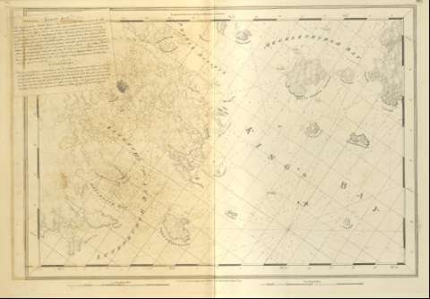
Lunenburg bay and Harbor, Kings bay, Dartmouth bay
Section: Maps, plans and nautical charts
Title: Lunenburg bay and Harbor, Kings bay, Dartmouth bay / J.F.W. Des Barres ; [Tomkins Scriptit, H. Ashby Sculpit]
Material or type of resouce Area: Escala [ca. 1:29048] (O 64°19'--O 63°55'/N 44°35'--N 44°20')
Publication: [London?] : J.F.W. Des Barres, 1776
Physical description: 1 mapa ; 68 x 97 cm
Content type: Imagen cartográfica
Media type: computadora
Carrier type: recurso en línea
Notes: The Sea Coast of Nova Scotia, Nº 16
Carta náutica en la que se señalan batimetría de sondas, veriles, y calidad del fondo de varios de los puertos y bahías que dominan la costa suroccidental de Nueva Escocia
Graduado respecto al meridiano de Greenwich y con escalas gráficas en millas legales y náuticas, inglesas
Orientado con nudo de 32 rumbos y declinación magnética
Presenta indicadores que informan de la duración y altura que alcanza la marea, en consonancia con relación de signos que presenta el volumen dentro del que se inserta este documento
Nota explicativa analizando en profundidad las bahías del área representada
toponimia costera y orografía de normales
Other authors: Ashby, Harry, 1744-1818
Tomkins, Thomas, 1743-1816
Related titles: Lunenburgh (Canadá). Cartas náuticas. 1776. 1:29048
UDC: 912:551.46]:551.468:627.22(716)"1776"
716
Type of publication:
![]() Maps
Maps
Préstamo:
![]()
![]() Disponible sólo para consulta en sala
Disponible sólo para consulta en sala


