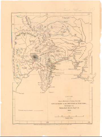
Map to illustrate a Journey from the City of Yeddo to the...


 Maps, plans and nautical charts
Map to illustrate a Journey from the City of Yeddo to the Mountain of Fusi - Yama (1861)
Maps, plans and nautical charts
Map to illustrate a Journey from the City of Yeddo to the Mountain of Fusi - Yama (1861)
 Disponible Holdings
 Section: Maps, plans and nautical charts
Title: Map to illustrate a Journey from the City of Yeddo to the Mountain of Fusi - Yama / Performed by Rutherford Alcock, Esqr. C.B. 1860 ; J. Arrowsmith
Material or type of resouce Area: Escala [ca. 1:1400000], 40 English Miles [= 4,5 cm] ; [proyec. Mercator] (E137°15'-E139°00'/N36°10'-N34°00')
Publication: London : Pubd. for the journal of the Royal Geographical Socy. by J. Murray, Albemarle Strt., 1861
Physical description: 1 mapa : col. ; 21,7x16 cm
Content type: Imagen cartográfica
Media type: computadora
Carrier type: recurso en línea
Notes: Precede al titulo : Japan
Red geográfica de 1° en 1°
Relieve representado por normales
Tabla de signos convencionales para indicar la ruta de Alcock
Materia / lugar / evento: Expediciones geográficas
1861
Other authors: Alcock, Rutherford, 1809-1897
Arrowsmith, John, 1790-1873
Murray, John
UDC: 912:910.4(52 Honshu, isla)'1860'
52 Honshu, isla
Type of publication:
Maps
Rights:
Préstamo:
Disponible
