Kriegs theater der Teutschen und Franzoesischen...


 Maps, plans and nautical charts
Kriegs theater der Teutschen und Franzoesischen Graenzlanden Zwischen dem Rheim und der Mosel : im iahr, 1794... (1794)
Maps, plans and nautical charts
Kriegs theater der Teutschen und Franzoesischen Graenzlanden Zwischen dem Rheim und der Mosel : im iahr, 1794... (1794)
 Disponible Holdings
 Section: Maps, plans and nautical charts
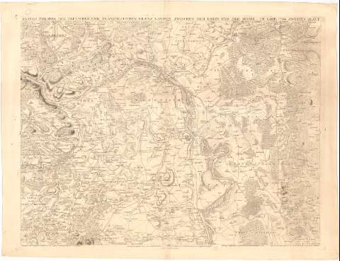
Title: Kriegs theater der Teutschen und Franzoesischen Graenzlanden Zwischen dem Rheim und der Mosel : im iahr, 1794 Zweites Blatt / zusamen gesetzet von dem C.P. Gl. P. Dewarat ; gestochen von Leizelt
Material or type of resouce Area: Escala [ca. 1:88000], 10000 toises [= 22 cm]
Publication: Plattz : Herausgegeben und Sr. Herzoglichnen Durchlaucht von Plalz Zweiybruck unterthamigst gewiedmet von J.L. C. Rheinwold, 1794
Physical description: 1 mapa ; 67,5x91,5 cm
Content type: Imagen cartográfica
Media type: computadora
Carrier type: recurso en línea
Notes: Escala gráfica de 2 'stund weges', [= 9,7 cm]. Orientado con los puntos cardinales
Relieve representado por normales y sombreado
Indica núcleos de población mediante edificios de perfil, masas forestales, cultivos y el curso del río Rhin con flecha
Other authors: Dewarat, Peter
Leizelt, B.F
Rheinwald, J.L.C
UDC: 912(430-328Renania-Palatinado)'1794'
(430-328 Hesse)
Type of publication:
Maps
Rights:
Préstamo:
Disponible
