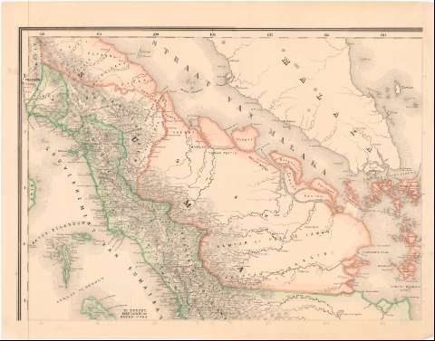
Kaart van Nederlandsch oost - Indie
Section: Maps, plans and nautical charts
Uniform title: INDONESIA. Colonias. 1:1800000 (1873)
Title: Kaart van Nederlandsch oost - Indie / naar de nieuwste bronnen bewerkt... dr. I. Dornseiffen ; door E. de Geest, lithograaf
Material or type of resouce Area: Escala 1:1800000 (E95°00'-E131°25'/N3°40'-S11°00')
Publication: Amsterdam : Seyffardts. Boekhandel, 1873
Physical description: 1 mapa en h. : col. ; h. de 36,5x46,5 cm
Content type: Imagen cartográfica
Media type: computadora
Carrier type: recurso en línea
Notes: Escalas gráficas de 60 'javasche palen' [= 5 cm], 15 millas geográficas [= 6 cm] y 60 millas inglesas [= 5,2 cm]
Relieve representado por normales
Mapa fraccionado
Tabla de signos convencionales para indicar, divisiones administrativas, núcleos de población de distinta categoría, etc.
Incompleto, faltan varias hojas
Other authors: Dornseiffen, I
Geest, E. de
UDC: 912:325.45(910)'1873'
910
Type of publication:
![]() Maps
Maps
Préstamo:
![]() Disponible
Disponible


