Iter. Bogen der angekundigten Situation Charte


 Disponible Holdings
 Section: Maps, plans and nautical charts
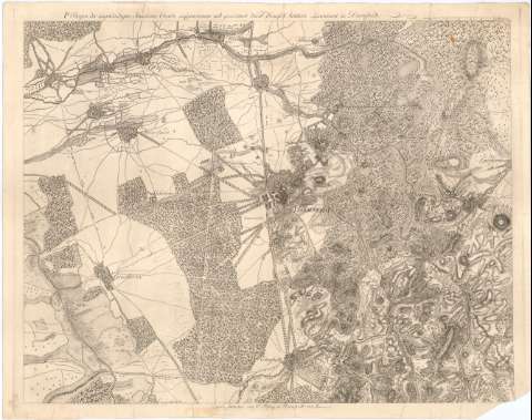
Title: Iter. Bogen der angekundigten Situation Charte / au genommen und gezeichnet durch Haafs Artillerie Lieutenant zu Darmstadt ; gestochen von C. Felsing in Darmstadt
Material or type of resouce Area: Escala [ca. 1:20000]
Publication: [Alemania ? : [Editor no identificado], 1820 ?]
Physical description: 1 mapa ; 49x62,5 cm en h. de 53,4x67,6 cm
Content type: Imagen cartográfica
Media type: computadora
Carrier type: recurso en línea
Notes: Relieve representado por normales
Indica masas forestales, caminos y núcleos de población
Sello en seco del Depósito de la Guerra
Other authors: Felsing, Johhan Conrad
UDC: 912:314(430-2 Darmstadt)'1820'
(430 Griesheim)
(430 Ober Ramstadt)
Type of publication:
 Maps
Maps
Rights:
Préstamo:
Disponible
