E. Wetzel's Wandkarte fur die Mathematische Geographie


 Disponible Holdings
 Section: Maps, plans and nautical charts
Uniform title: UNIVERSO. Mapas celestes. Escala indeterminada (1884)
Title: E. Wetzel's Wandkarte fur die Mathematische Geographie
Material or type of resouce Area: Escala indeterminada
Publication: Berlin : Verlag von Dietrich Reimer, 1884
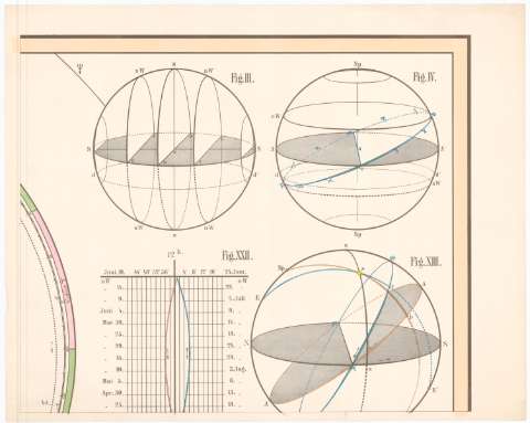
Physical description: 1 Carta celeste en 9 h. ; 1 hemisferio, 181'5x230'5 cm en h. de 60'6x76'8 cm
Content type: Imagen cartográfica
Media type: computadora
Carrier type: recurso en línea
Notes: Presenta además 26 figuras de datos Cosmográficos
Representa las constelaciones por sus signos primitivos
Incompleto. Faltan 2 hojas
Materia / lugar / evento: Mapas celestes
1884
Other authors: Wetzel, E
Reimer, Dietrich
UDC: 912:[523/524]:524.8'1884'
Type of publication:
 Maps
Maps
Rights:
Préstamo:
Disponible
