Environs de Paris au 1:320000


Section: Maps, plans and nautical charts
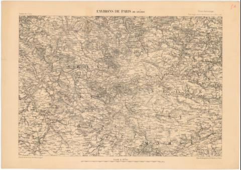
Uniform title: PARIS (Francia) (Región). Mapas generales. 1:320000 (1852)
Title: Environs de Paris au 1:320000
Material or type of resouce Area: Escala 1:320000
Publication: Paris : Imp. de Kaeppelin Q. Voltaire, 1852
Physical description: 1 mapa ; 35,2x51,6 cm en h. de 43x61 cm
Notes: Relieve representado por normales y puntos acotados
En el márgen superior derecha : Precis historique. Etat - mayor. Carte de la France au 1:320000, 1852. En el margen inferior izquierdo : Extrait de la Carte de L'Etat - major
Indica límites administrativos y masas forestales
FRN
Materia / lugar / evento: Mapas generales
1852
Other authors: Kaeppelin et Cie
UDC: 912(44-328 Paris)'1852'
44-328 Paris
Type of publication:
 Maps
Maps
Rights:
Préstamo:
 Disponible
