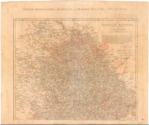
Die Baierische Monarchie entworfen in zwey Blattern


 Disponible Holdings
 Section: Maps, plans and nautical charts
Uniform title: BAVIERA (Alemania). Mapas generales. 1:600000 (1808)
Title: Die Baierische Monarchie entworfen in zwey Blattern / von Conrad Mannert ; C.M. Trummer sc
Material or type of resouce Area: [Ca. 1:600000], 8 Geographische Meilen 15 = grad. [= 9,7 cm] ; [proyec. cónica]
Publication: Nurnberg : bey Homanns Erben, 1808
Physical description: 1 mapa en 2 h. : col. ; 112x66,8 cm en h. de 55,9x66,8 cm
Content type: Imagen cartográfica
Media type: computadora
Carrier type: recurso en línea
Notes: Escalas gráficas de 10 'Franzosische Meilen' 25 = grad [= 3,7 cm], 25 'italienische Meilen' 60 = grad. Coordenadas referidas al meridiano de hierro (E27°-E31°30'/N50°40'-N45°35'). Red geográfica de 1° en 1°
Relieve representado por normales
Relación de los nombres de los distintos, indicados por clave numérica
Tabla de signos convencionales para indicar ; núcleos de población de distinta categoría, fortificaciones, monasterios, etc
En el margen superior, 'Seiner Koniglichen Majestat von Baiwern Maximilian Joseph'
Nota sobre los mapas que han servido de base para la formación de este
Indica masas forestales
Procede de la 'Colección Rico y Sinobas'
Materia / lugar / evento: Mapas generales
1808
Tirol (Estado)
Italia
Other authors: Mannert, Conrad
Trummer, C.M
Homann Erben (Firma)
UDC: 912(430-328 Baviera)'1808'
(436-328 Tirol)
(45-17)
Type of publication:
 Maps
Maps
Rights:
Préstamo:
Disponible
