Der Orient


Section: Maps, plans and nautical charts
Uniform title: Europa. Mapas generales. 1:2000000 (188)
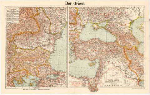
Title: Der Orient
Material or type of resouce Area: Escala 1:2000.000 (E22°0'-E30°10'/N48°15'-N39°50') ; [proyec. Cónica]
Publication: Leipzig : Verlag von Velhagen & Klafinf, [188- ?]
Physical description: 2 mapas en 1 h. : col. ; 49x88 cm en h. de 57x90 cm
Content type: Imagen cartográfica
Media type: computadora
Carrier type: recurso en línea
Notes: Escalas graficas de 100 Km [= 6 cm], 300 Km [= 7 cm]. Red geografica de 1° en 1°.
Relieve representado por sombreado Sondas batimetricas
Tabla de signos convencionales para indicar las lineas telegraficas
Other authors: Velhagen und Klasing (Firma)
UDC: 912(4-11)'1880/1889'
(6-17)
(496.1)
Type of publication:
 Maps
Maps
Rights:
Préstamo:
 Disponible
