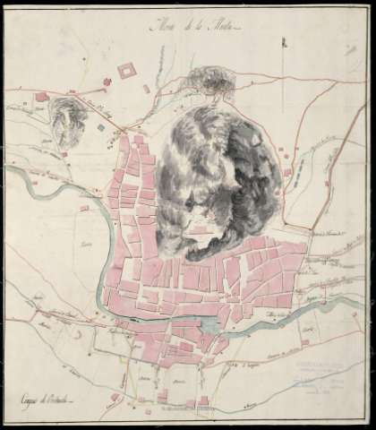
Croquis de Orihuela


Section: Maps, plans and nautical charts
Uniform title: ORIHUELA (Alicante). Planos de población. 1:5.000 (1812?)
Title: Croquis de Orihuela
Material or type of resouce Area: Escala [ca. 1:5.000]
Publication: [1812?]
Physical description: 1 plano : ms., col., montado sobre tela ; 48,5 x 42 cm
Content type: Imagen cartográfica
Media type: computadora
Carrier type: recurso en línea
Notes: Manuscrito a plumilla en tinta negra y coloreado a la acuarela en gris, ocre, azul, amarillo y carmín
Orientado con media torre
Relieve representado por sombreado
Indica fortificaciones de la ciudad, huertas y azarbes
Incompleto, falta la explicación
Materia / lugar / evento: Planos de población
Fortificaciones
Caminos
Guerras de independencia
1812
Orihuela
Alicante (Provincia)
Comunidad Valenciana
España
España - Historia - 1808-1814 (Guerra de la Independencia)
Genre / form: Manuscritos
UDC: 912:314(467.33 Orihuela)'1812'(084.3)
912:623.2]:625.7(467.33 Orihuela)'1812'
Type of publication:
 Maps
Maps
Rights:
Préstamo:
 Disponible
