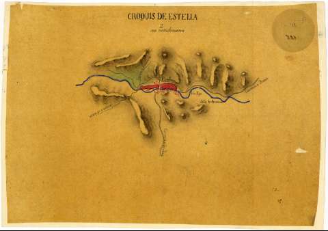
Croquis de Estella y sus inmediaciones


Section: Maps, plans and nautical charts
Uniform title: ESTELLA (Navarra) (Término municipal). Mapas generales. Escala indeterminada (1820?)
Title: Croquis de Estella y sus inmediaciones
Material or type of resouce Area: Escala indeterminada
Physical description: 1 mapa : ms., col., papel vegetal ; 25,4 x 36,8 cm
Content type: Imagen cartográfica
Media type: computadora
Carrier type: recurso en línea
Notes: Fecha tomada del catálogo del SGE: "Región Vasco-Navarra. Provincia de Navarra. Siglos XVII a XIX". 1969, p. 450
Orografía por sombreado
Iluminado en verde, carmín, azul y gris
Materia / lugar / evento: Mapas generales
1820
Navarra (Comunidad Autónoma)
UDC: 912(465.111.2)"1820"
465.111.2 Estella, Término Municipal
Type of publication:
 Maps
Maps
Rights:
Préstamo:
 Disponible
