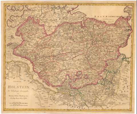
Charte von Holstein


Section: Maps, plans and nautical charts
Uniform title: SCHLESWIG-HOLSTEIN (Alemania). Mapas generales. 1:320000 (1807)
Title: Charte von Holstein
Material or type of resouce Area: Escala [ca. 1:320000], 3 Gemeine Deutsche Meilen [= 6, 9 cm]
Publication: Nurnberg : Mit Verbesferungen herausgegeben von Homanns Erben, 1807
Physical description: 1 mapa ; 46,5x55,5 cm en h. de 50,4x59,5 cm
Content type: Imagen cartográfica
Media type: computadora
Carrier type: recurso en línea
Notes: Escala gráfica de 4 Franzosische Meilen [= 6,7 cm]. Coordenadas referidas, al parecer, al meridiano de Hierro (E28#24'-E31#02'/N55#00'-N54#42'). Recuadro geográfico de 10' en 10'
Relieve de perfil
Indica límites de divisiones administrativas por color
Materia / lugar / evento: Mapas generales
Divisiones administrativas
1807
UDC: 912(430-328 Schleswig-Holstein)'1807'
430-328 Schleswig-Holstein
Type of publication:
 Maps
Maps
Rights:
Préstamo:
 Disponible
