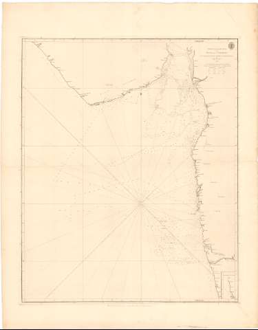
Chart of part of the Coasts of India and Guzarat : From...
Section: Maps, plans and nautical charts
Uniform title: GUJARAT (India). Cartas náuticas. 1789. 1:750000 (1788)
Title: Chart of part of the Coasts of India and Guzarat : From a Survey made by order and at the expence of the East - India - Company / by John Mc. Cluer ; W. Harrison
Material or type of resouce Area: Escala [ca. 1:750000]
Publication, Production, Distribution, etc.: Publicación: [London ?] : Published according to Act. of Parliament by A. Dalrymple Novr. 7th..., 1789
Fabricación: [London ?] : Sold by R.B. Bate. 21. Poultry for the Lords Commifs. of the Admiralty by their Appountment, 1789
Physical description: 1 carta náutica ; 70,6x56,1 cm en h. de 85,2x66,6 cm
Content type: Imagen cartográfica
Media type: computadora
Carrier type: recurso en línea
Notes: Escala hallada a partir de un grado de la Latitud
Orientado con lis en nudo de rumbos
Relieve representado por normales
Indica veriles, bajos, sondas batimétricas en pies. Clave hidrográfica para determinar la calidad del fondo
Sello de la Hydrographical Office
Other authors: McCluer, John
Bate, R. B
Dalrymple, Alexander
UDC: 912:[551.46:551.468](540-328 Gujarat)
540-328 Gujarat
Type of publication:
![]() Maps
Maps
Préstamo:
![]() Disponible
Disponible


