Carta topográfica dello Stato Pontificio e del Gran -...


 Maps, plans and nautical charts
Carta topográfica dello Stato Pontificio e del Gran - Ducato di Toscana = Topógraphische Karte des Kirchenstaates...
Maps, plans and nautical charts
Carta topográfica dello Stato Pontificio e del Gran - Ducato di Toscana = Topógraphische Karte des Kirchenstaates...
 Disponible Holdings
 Section: Maps, plans and nautical charts
Uniform title: ITALIA. Central. Mapas generales. 1:86400 (1851)
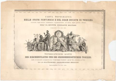
Title: Carta topográfica dello Stato Pontificio e del Gran - Ducato di Toscana = Topógraphische Karte des Kirchenstaates und des Grossnerzogrumes Toscana / construtta sopra misure astronomico trigonometriche ed incisa sopra pietra a vienna nell'I.R. Istituto Geografico Militar = nach astronomisch trigonometrischen Vermessungen bearbeited und auf Stein gestochen zu Wien IM K.K. Militarischen Geographischen Institute
Material or type of resouce Area: Escala 1:86400
Publication: Wien : [K.K. Mititarische Geografische Institut]
Physical description: 1 mapa en 52 h. ; h. de 58,5x86,1 cm
Notes: Coordenadas referidas, al parecer, al meridiano de hierro (E27°10'-E36°6'/N45°12'-40°54')
Relieve representado por sombreado
Tabla de signos convencionales para indicar, nucleos de población de distinta categoría, suelos, puertos, yacimientos minerales, limites administrativos, etc.
Tabla de elevaciones de varios puntos trigonométricos del ducado de Toscana y del estado pontificio de Sopra sobre el nivel del mar
Sello en seco del 'Depósito de la Guerra'
ITL
Materia / lugar / evento: Mapas generales
Divisiones administrativas
1851
Other authors: Monarquía austro-hungara. Militärgeographisches Institut
UDC: 912:528.4(45-2/-5)
45
Type of publication:
Maps
Rights:
Préstamo:
Disponible
