Base de Madridejos : Lam. I


Section: Maps, plans and nautical charts
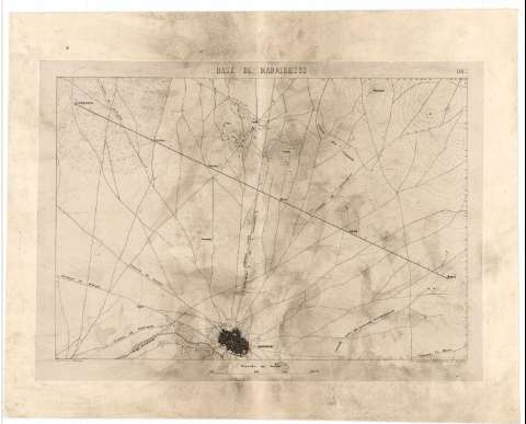
Title: Base de Madridejos : Lam. I / Grabdo. por P. Braun
Material or type of resouce Area: Escala 1:50000
Publication: Madrid : Lit. Alemana, Fuencarral 20, [1858?]
Physical description: 1 mapa ; 20 x 29 cm
Content type: Imagen cartográfica
Media type: computadora
Carrier type: recurso en línea
Notes: Comprende la villa de Madridejos y parte de sus alrededores en un radio aproximado de 8 km.
Fecha de publicación tomada del catálogo del SGE: "Castilla la Nueva. Provincias de Toledo, Ciudad Real, Cuenca y Guadalajara. Siglos XVII a XIX", p. 213
Escala también dada en forma gráfica, de 3000 metros
Orografía por curvas de nivel equidistantes 5 metros
Indica los vértices que han servido para el levantamiento del presente mapa
Relacionado con el documento de sign. SGE-Ar.E-T-C.4-213(2) en el que se representan las triangulaciones de los vértices aquí trazados
Materia / lugar / evento: Mapas topográficos
1858
Levantamiento topográfico
Toledo (Provincia)
Castilla-La Mancha
Other authors: Braun, P
Litografía de F. Kraus (Madrid)
UDC: 912:528.4(464.218)"1858"
464.218 Madridejos
Type of publication:
 Maps
Maps
Rights:
Préstamo:
 Disponible
