Albaida


Section: Maps, plans and nautical charts
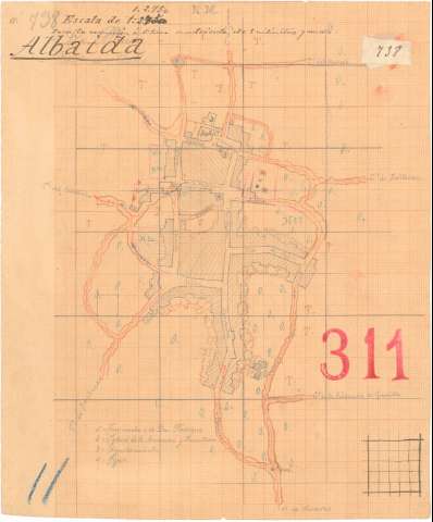
Title: Albaida
Material or type of resouce Area: Escala 1:2.750
Publication: 1870
Physical description: 1 plano : ms., col., papel milimetrado ; 24,9 x 20,6 cm
Notes: Presenta el plano de población de Albaida de Aljarafe
Orientado con flecha
Manuscrito a lápiz en colores, negro, siena, rojo, azul y carmín
Señala la vegetación del pueblo por clave alfabética
Relación de los principales edificios civiles y religiosos indicada por clave numérica
En el margen superior: "738" y "Para la reducción á 1:5000 cuadrícula de 9 milimetros y medio". En el margen inferior "11". En el margen derecho "311"
Materia / lugar / evento: Planos de población
Edificios públicos
Edificios religiosos
Vegetación
1870
Sevilla (Provincia)
Andalucía
UDC: (460.353 Albaida de Aljarafe)
Type of publication:
 Maps
Maps
Rights:
Préstamo:
 Disponible
