[Plano de Castell - Vide y sus inmediaciones en la...


 Maps, plans and nautical charts
[Plano de Castell - Vide y sus inmediaciones en la provincia de Alentejo (180-?)
Maps, plans and nautical charts
[Plano de Castell - Vide y sus inmediaciones en la provincia de Alentejo (180-?)
 Disponible Holdings
 Section: Maps, plans and nautical charts
Uniform title: ALTO ALENTEJO (Portugal). E. Mapas generales (180). 1:24000
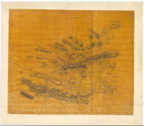
Title: [Plano de Castell - Vide y sus inmediaciones en la provincia de Alentejo / Ejército Portugués]
Material or type of resouce Area: [Ca. 1:24000]
Publication: [180-?]
Physical description: 1 mapa : ms., col., montado sobre tela ; 47,8 x 57,3 cm en h. de 56,1 x 64,5 cm
Content type: Imagen cartográfica
Media type: computadora
Carrier type: recurso en línea
Notes: Comprende el este de la provincia del Alto Alentejo
Título y mención de responsabilidad tomados del Catálogo del SGE: "Portugal. Siglos XVI a XIX". 1972. P. 164
Manuscrito a plumilla en tinta negra y roja y coloreado a la acuarela en carmín y gris
Relieve representado por sombreado
Indica caminos y vegetación
En el márgen inferior: "N 5 Binet" y "190 M"
Sello del Depósito General de la Guerra
Other authors: Portugal. Exército
UDC: 912(469-328 Alto Alentejo)'1800/1809'
(469 Castelo de Vide)
Type of publication:
Maps
Rights:
Préstamo:
Disponible
