[Badajoz y alrededores]


Section: Maps, plans and nautical charts
Uniform title: Badajoz. Mapas generales. 1:29.000 (175)
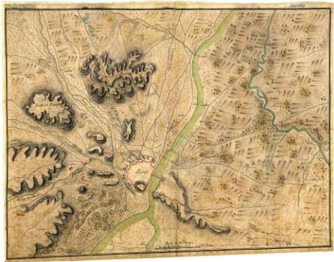
Title: [Badajoz y alrededores]
Material or type of resouce Area: Escala [ca. 1:29000], 1000 tuesas [= 6,7 cm]
Physical description: 1 mapa : ms., col., montado sobre tela ; 36,9 x 48,9 cm en h. de 38,8 x 50 cm
Content type: Imagen cartográfica
Media type: computadora
Carrier type: recurso en línea
Notes: Presenta lel plano de la ciudad y sus contornos
Título propio tomado del Catálogo del Servicio Geográfico del Ejército: "Extremadura. Siglos XVIII al XIX". 1972, p. 155
Relieve representado por sombreado
Manuscrito a plumilla en tintas negra y roja y coloreado a la acuarela en verde, siena y gris
Indica vegetación y cultivos
Materia / lugar / evento: Mapas generales
Fortificaciones
Siglo XVIII
Badajoz (Provincia)
UDC: 460.253 Badajoz
Type of publication:
 Maps
Maps
Rights:
Préstamo:
 Disponible
