L'Hydrographie Françoise


Section: Maps, plans and nautical charts
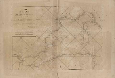
Uniform title: Mundo. Cartas náuticas. Varias escalas (1793-1878)
Title: L'Hydrographie Françoise / [Jacques Nicolas Bellin]
Material or type of resouce Area: Escalas dif
Publication: [París : Jacques Nicolás Bellin, 1762?]
Physical description: 1 atlas (44 h.) : 40 map., col. ; 67 cm
Content type: Imagen cartográfica
Media type: computadora
Carrier type: recurso en línea
Notes: Atlas formado por 40 cartas de arana o, en su defecto, arrumbadas de las costas y mares de todo el mundo
Título tomado de los atlas MN-10047, 10047 bis, 10049 y 10054, que contienen una serie de mapas similares a los de éste ejemplar realizados por Bellin en el Dcpôt des Cartes et Plans de la Marine
El pie de imprenta ha sido tomado de los mapas todos ellos editados por Bellin (excepto dos), entre 1745 y 1762
Todos ellos presentan escalas de leguas de 20 al grado. Coordenadas referidas al meridiano de París y en una mayoría también a los de Ferro, Tenerife, cabo Lezard y Londres
Encuadernado en cartón forrado en piel, con una estampación prácticamente perdida
Materia / lugar / evento: Atlas
Cartas náuticas
Other authors: Bellin, Jacques Nicolas, 1703-1772
Francia. Dépôt des Cartes et Plans de la Marine
UDC: 912:551.46](100)(084.4)"1762"
100
Type of publication:
 Maps
Maps
Rights:
Préstamo:
 Disponible
