Africa


Section: Maps, plans and nautical charts
Uniform title: AFRICA. Mapas generales. 1:7000000 (1802)
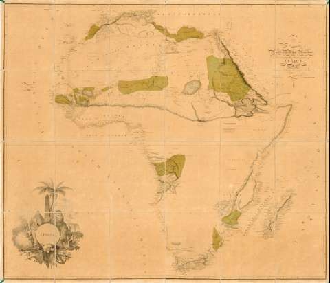
Title: Africa / A. Arrowsmith
Material or type of resouce Area: [Ca. 1:7000000] (O 40°-E 65°/N 35°-S 35°)
Publication: London : Published by A. Arrosmith, Rathbone Place, November 1r. 1802
Physical description: 1 mapa : col., montado sobre tela ; 124 x 146 cm en h. de 128 x 148,4 cm
Content type: Imagen cartográfica
Media type: computadora
Carrier type: recurso en línea
Notes: Dedicatoria: "To the Committe and Members of the British Association, for Discovering the Interior parts of Africa"
Escala hallada a partir de un grado de latitud [= 1,64 cm]. Red geográfica de 5° en 5°
Relieve representado por normales y sombreado
Indica algunos países mediante color, veriles y bajos
Nota sobre los monzones en el canal de Mozambique
Materia / lugar / evento: Mapas generales
Fronteras
Topónimos antiguos
1802
África
Other authors: Arrowsmith, Aaron, 1750-1823
UDC: 912:341.222(6)'1802'
6
Type of publication:
 Maps
Maps
Rights:
Préstamo:
 Disponible
