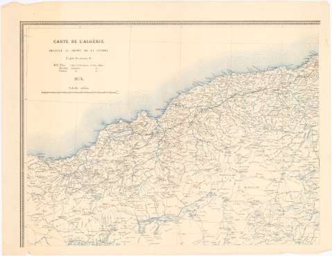
Carte de L'Algérie


Section: Maps, plans and nautical charts
Uniform title: Argelia. Mapas generales (1876). 1:800000
Title: Carte de L'Algérie / Dressée au Dépot de la Guerre..
Material or type of resouce Area: 1:800000
Publication: Paris : Publié par le Dépot de la Guerre, 1876 (Paris : Imp. Lemercier & Cie.)
Physical description: 1 mapa en 4 h. : col. ; h. de 55,5 x 72,3 cm
Content type: Imagen cartográfica
Media type: computadora
Carrier type: recurso en línea
Notes: Coordenadas referidas al meridiano de París (O 5°-E 6°/N 37°-N 30°). Red geográfica de 1° en 1°
Other authors: Lemercier
Francia. Dépôt de la guerre
UDC: 912(65)'1876'
65
Type of publication:
 Maps
Maps
Rights:
Archivo Cartográfico de Estudios Geográficos del Centro Geográfico del Ejército
Collection: PCGE — Location: AR — Call number: Ar.Q-T.10-C.1-49(1) — Código de barras: 2211797
Préstamo:
 Disponible

© Ministerio de Defensa de España
P. de la Castellana, 109 28071 Madrid.
Tlf: (34) 91 395 50 00
Email: patrimonio.cultural@oc.mde.es