Ilha de S. Thomé


Section: Maps, plans and nautical charts
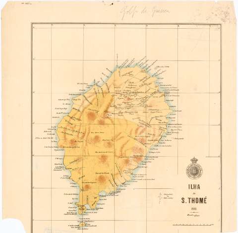
Title: Ilha de S. Thomé
Material or type of resouce Area: Escala 1:150000 ; [proyec. cilindrica Mercator] (E6°22'-E6°53'/N0°30'-S0°03')
Publication: Lisboa : Sociedade de Geographia de Lisboa, 1888
Physical description: 1 mapa : col. ; 41,5x36,6 cm en h. de 50x44,8 cm
Content type: Imagen cartográfica
Media type: computadora
Carrier type: recurso en línea
Notes: Pertenece al 'Boletim da Sociedade de Geographia, Serie 8'.
Red geográfica de 5' en 5'
Relieve representado por curvas de configuración
Materia / lugar / evento: Mapas físicos
1888
Other authors: Sociedade de Geographia de Lisboa
UDC: 912:911.2(669.95 Santo Tomé, isla)'1888'
669.95 Santo Tomé, isla
Type of publication:
 Maps
Maps
Rights:
Préstamo:
 Disponible
