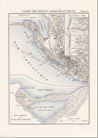
Carte des Monts Acrocérauniens


 Disponible
 Section: Maps, plans and nautical charts
Uniform title: Albania. Geografía histórica (1887). 1:247000
Title: Carte des Monts Acrocérauniens
Material or type of resouce Area: 1:247000
Publication: [París] : Imprimerie Nationale, [1887]
Physical description: 1 mapa : col. ; 18 x 20 cm en h. de 27 x 20 cm
Content type: Imagen cartográfica
Media type: computadora
Carrier type: recurso en línea
Notes: Escala gráfica además en "kilométres"
Relieve representado por sombreado y puntos acotados
Inserta: Plage de Palaeste. Escala 1:60000
Copia digital. España : Ministerio de Cultura y Deporte. Subdirección General de Coordinación Bibliotecaria, 2010
Plan D'Oricum et de son part intérieur
Other titles: En: Histoire de Jules César : Guerre Civile : Planches : [atlas]. - París : Imprimerie Nationale, 1887. - Pl. 12
Materia / lugar / evento: Geografía histórica
Itinerarios
Montañas
Imperio romano
Albania
UDC: 912:913.1]:[656.02:551.43](496.5)'-0053/-0044'
37
496.5
234 Acroceraumiens
Type of publication:
 Maps
Maps
Rights:
