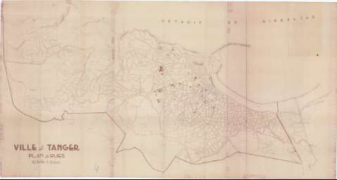
Ville de Tánger : Plan des rues


Section: Maps, plans and nautical charts
Uniform title: Tánger. Planos de población. 1949?. Francés. 1:5.000
Title: Ville de Tánger : Plan des rues
Material or type of resouce Area: Escala 1:5.000
Publication: [Lugar de publicación no identificado] : [Editor no identificado], [1949?]
Physical description: 1 plano en 3 h. : copia heliográfica ; 91 x 172 cm en h. de 91 x 58 cm
Content type: Imagen cartográfica
Media type: computadora
Carrier type: recurso en línea
Materia / lugar / evento: Planos de población
1949
Tánger (Provincia)
Tánger
Tánger-Tetuán (Marruecos, Región)
Marruecos
UDC: (642 Tánger)
Type of publication:
 Maps
Maps
Rights:
Archivo Cartográfico de Estudios Geográficos del Centro Geográfico del Ejército
Collection: PCGE — Location: DE — Call number: MAR-C.11-119 — Código de barras: 9788295 — Notes: Bueno
Préstamo:
 Disponible

© Ministerio de Defensa de España
P. de la Castellana, 109 28071 Madrid.
Tlf: (34) 91 395 50 00
Email: patrimonio.cultural@oc.mde.es