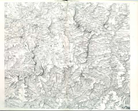
Carballiño y Chantada


Section: Maps, plans and nautical charts
Uniform title: Pontevedra (Provincia). Mapas generales. 1845. 1:100.000
Title: Carballiño y Chantada
Material or type of resouce Area: Escala 1:100.000
Physical description: 1 mapa ; 62 x 80 cm
Content type: Imagen cartográfica
Media type: computadora
Carrier type: recurso en línea
Notes: Relieve representado por normales
Núcleos de población, lugares y edificios más representativo
Hidrografía
Caminos
En margen superior: Coruña y Betanzos
En margen izquierdo: Pontevedra
En margen derecho: Monforte
En margen inferior: Orense
Copia digital. Madrid : Ministerio de Cultura, 2010
Materia / lugar / evento: Mapas generales
Núcleos de población
Carreteras
Montañas
Ríos
Accidentes geográficos
1845
Pontevedra (Provincia)
Orense (Provincia)
Related titles: Orense (Provincia). Mapas generales. 1845. 1:100.000
UDC: (460.117-28 O Carballiño)"1845"
(460.113-28 Chatanda)
Type of publication:
 Maps
Maps
