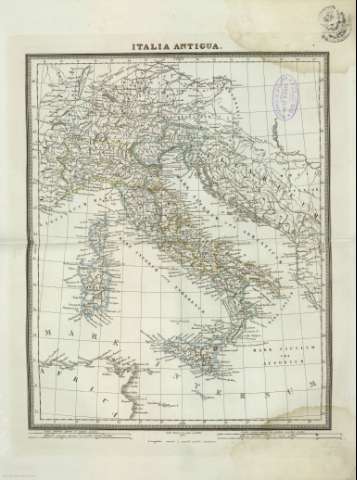
Italia antigua


Section: Maps, plans and nautical charts
Uniform title: Italia. Mapas generales. 1835. Latín. 1:4.004.000 (1832)
Title: Italia antigua / Pablo Alabern lo grabó en Barna 1832
Material or type of resouce Area: Escala [ca. 1:4.004.000]. 500 lecuae hispanicas quarum 20 aeguant gradum [= 11,1 cm] ( (E 8º 40'-E 25º 20'/N 48º 40'-N 35º 00)
Publication: [Barcelona] : [en la imprenta y libreria de José Torner, calle Regomi], [1835]
Physical description: 1 mapa : col. ; 41x54 cm, pleg. en 41x24 cm
Content type: Imagen cartográfica
Media type: computadora
Carrier type: recurso en línea
Notes: Este mapa también se encuentra en un atlas sin portada y con encuadernación facticia, conservado en la Cartoteca del Archivo General Militar de Madrid
Escala gráfica también expresada en otras unidades
Longitud oriental de Madrid
Relieve representado por normales
Coloreados los límites administrativos
Materia / lugar / evento: Mapas generales
Divisiones administrativas
Imperio romano
Geografía histórica
Italia
Other authors: Alabern, Pablo, 1804-1860
UDC: 912:913.1]:(45-2/-5)
(45)
Type of publication:
 Maps
Maps
Rights:
Préstamo:
 Disponible
