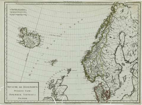
Royaume de Danemarck : premiere Carte Danemarck, Norwege...


 Maps, plans and nautical charts
Royaume de Danemarck : premiere Carte Danemarck, Norwege et Islande (1797 ?)
Maps, plans and nautical charts
Royaume de Danemarck : premiere Carte Danemarck, Norwege et Islande (1797 ?)
 Disponible Holdings
 Section: Maps, plans and nautical charts
Uniform title: Escandinavia. Mapas generales (1797). 1:6410250
Title: Royaume de Danemarck : premiere Carte Danemarck, Norwege et Islande / Tardieu sculp. ; André scrip.
Material or type of resouce Area: Escala [ca. 1:6410250], 75 Lienes Communes de France, de 25 au Degré
Publication: Paris : Chez Mr. Mentelle ... , Rue de Seine Fauxbourg S. Germain ..., [1797 ?]
Physical description: 1 mapa : col. ; 34x49 cm
Content type: Imagen cartográfica
Media type: computadora
Carrier type: recurso en línea
Notes: Escala gráfica además en 'Lieues Marines, de 20 au Degré', etc. Coordenadas : O29 E33 /N71 -N53 . Meridiano de Paris. Coordenadas también del meridiano de Ferro
Márgenes graduados. - Dibujados meridianos y paralelos formando una cuadrícula. - Relieve representado por montes de perfil y sombreado. - Red hidrográfica destacada. - Países delimitados por línea de color. - Costas sombreadas con un fino rayado. - Toponímia
Copia digital. España : Ministerio de Cultura. Dirección General del Libro, Archivos y Bibliotecas, 2010
Other titles: En: Atlas nouveau. - Paris : Chez Mr. Mentelle Historiographe de Monseigneur le Comte d'Antois, Rue de Seine Fauxbourg S. Germain, Hotel de Mayence, [1797 ?]
Materia / lugar / evento: Mapas generales
Divisiones administrativas
Islandia
Dinamarca
Noruega
Suecia
Other authors: André, Gaspard, fl. 1768-1801
Tardieu, Antoine-François, 1757-1822
Mentelle, Edmé, 1730-1815
UDC: 912(489+491.1+481+485)
489
491.1
481
485
Type of publication:
Maps
Rights:
Préstamo:
Disponible
